|
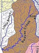 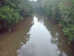
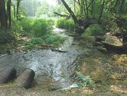
Beaver Creek has its source in northern Douglas County. It drains
a total watershed area of 425 square miles. Grassland covers 183
square miles, or about 44%. The northern part of the watershed is
mostly gently rolling hay and pasture land. Forest and woodland
cover 230 square miles, or 54% of the watershed, most of it in the
rugged hills to the south. Part of the forested area is within the
boundaries of the Mark Twain National Forest. A small portion of
the land, less than 0.25% of the total, is in row crops. There are
no sizeable towns within in the watershed. Bradleyville, at the
crossing of Routes 76 and 125, is the only town with a business
district. The town of Ava, the Douglas County seat, lies along
the eastern edge of the watershed.
In northeast Taney County Beaver Creek is joined by its tributary,
Little Beaver Creek, which drains the northwestern part of
the watershed. From there Beaver Creek continues on for another
16 miles to Bull Shoals Lake.
|