 South
Fork of the Spring River
South
Fork of the Spring River
Tingler Prairie, Vanderhoef Forest, and White Ranch
Spring River Watershed
![]() Spring River Photo Tour
Spring River Photo Tour ![]() South Fork
South Fork
 |
This series of photos follows Hwy.
17 going south of West Plains, with side trips along county roads
to Tingler Prairie, Vanderhoef Forest, and White Ranch Conservation
Area. Much of the landscape is very gently rolling land, with shallow
sinkholes, forming ponds. This makes for good pastures and cattle
and dairy operations. 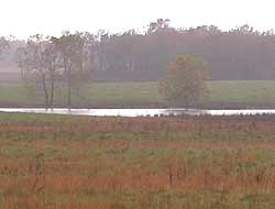 |
|
|
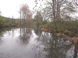
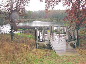
This viewing deck over looks five-acre Tingler Pond, set in a sinkhole. Tingler Prairie is one of very few remaining prairie examples left in the Ozark Region. It is a wet-mesic prairie containing more than 100 native species of grasses, sedges and forbs including two varieties of the state endangered green orchid. For more photos of Tingler Prairie, see this Nature Journal from the Ozarks Chapter of Missouri Master Naturalists. |
||
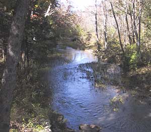 |
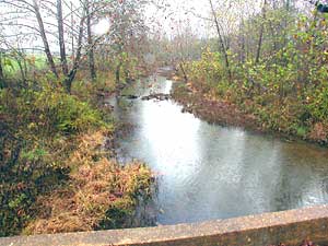
Archie and Gracie Vanderhoef Memorial State Forest The South Fork of the Spring River is a permanent stream running through this forest. This State Forest was donated to the Missouri Department of Conservation in 1988 by the Archie and Gracie Vanderhoef family, which had cared for it since pioneer days. |
|
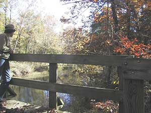
Looking downstream from the viewing deck along the nature trail. The area is mostly forest. Features include a nature trail with a diversity of native plant life and a picnic area, as well as the river. The 140-acre forest is a perfect place for nature lovers and fishermen. Directions: Go 3 miles west of West Plains on Highway 160. Turn 8 miles south on Route JJ, a half-mile mile east on County Road 9620, and a half-mile south on County Road 8110. |
||
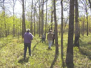 |
White Ranch Conservation Area is a mosaic of oak forest, savanna, and fens. This area was regularly burned off during the expansion and migration of the Osage Tribe from 1710 to 1830.
|
|
 |
There are various forest management activities ongoing at White Ranch that are designed to improve tree growth, quality and species composition. These practices also improve wildlife habitat and watershed quality. | |
 |
From White Ranch, the South Fork flows in a westerly direction on its way to meet West Fork, 2 miles north of the Arkansas state line. |
|
 Tingler
Prairie
Tingler
Prairie 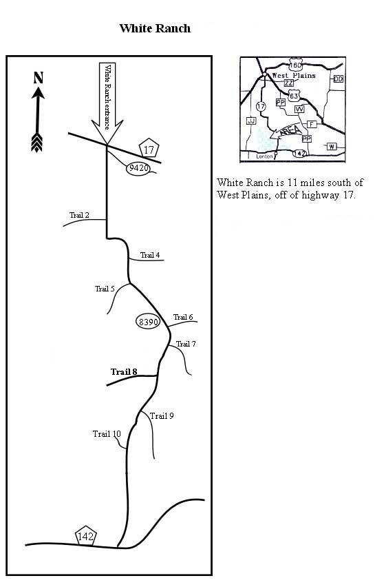
Photos and text by Peter Callaway.
 The
development of content for *Our Watersheds Our Homes* is funded in part
by the U.S. Environmental Protection Agency Region 7, through the Missouri
Department of Natural Resources, under Section 319 of the Clean Water
Act. DNR Subgrant #G04-NPS-17.
The
development of content for *Our Watersheds Our Homes* is funded in part
by the U.S. Environmental Protection Agency Region 7, through the Missouri
Department of Natural Resources, under Section 319 of the Clean Water
Act. DNR Subgrant #G04-NPS-17.