 Warm
Fork of the Spring River and Thayer
Warm
Fork of the Spring River and Thayer
Spring River Watershed
![]() Spring River Photo Tour
Spring River Photo Tour ![]() Warm Fork and Thayer
Warm Fork and Thayer
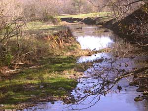 |
Warm Fork at Howell County Road 397, also known as Wiggins Ford. The river cuts through pastureland, with no riparian belt. | |
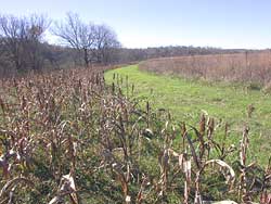 |
Warm Fork Conservation Area, managed by Missouri Dept. of Conservation. Go 5 miles east of Koshkonong on Route Z, then north a tenth of a mile on Howell County Road P-323. This area is mostly old fields and grassland mixed with forest and cropland. Sorghum has been planted for wildlife food along a mowed strip. Trees border Warm Fork to left. |
|
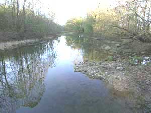 Warm Fork at County Road 256, very near Thayer. |
|
|
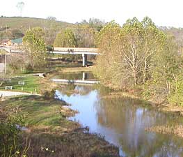 Warm Fork flows on into Thayer. This photo was taken at the Chestnut Street bridge in town. US Highway 63 bridge is in the background. |
||
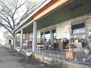 |
Along Front Street in Thayer, the old Colonial Hotel, now an antique shop. The Colonial Hotel was the best lodging address in town, as it was just a short walk from the old Frisco train depot. In addition to travelers stopping overnight before proceeding on, the hotel was headquarters for train crews awaiting arrival of a train to either Memphis or Springfield. Meals were served family style, as all guests ate at the same large table. |
|
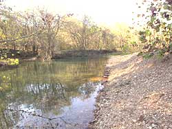 A
broad stretch of gravel next to the road offers a picnicking beach
for Thayer locals.
A
broad stretch of gravel next to the road offers a picnicking beach
for Thayer locals.Photos and text by Peter Callaway.
 The
development of content for *Our Watersheds Our Homes* is funded in part
by the U.S. Environmental Protection Agency Region 7, through the Missouri
Department of Natural Resources, under Section 319 of the Clean Water
Act. DNR Subgrant #G04-NPS-17.
The
development of content for *Our Watersheds Our Homes* is funded in part
by the U.S. Environmental Protection Agency Region 7, through the Missouri
Department of Natural Resources, under Section 319 of the Clean Water
Act. DNR Subgrant #G04-NPS-17.