 Howell
Creek
Howell
Creek
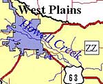
Spring River Watershed
![]() Spring River Photo Tour
Spring River Photo Tour ![]() Howell Creek
Howell Creek
 The
headwaters of the Spring River can be said to begin with Howell Creek,
which arises within the city limits of West Plains. It is classified as
a losing stream, one that loses much or all of its flow to the groundwater
system, typical of the karst topography
in this area. It ceases to flow in dry periods but maintains some permanent
stretches.
The
headwaters of the Spring River can be said to begin with Howell Creek,
which arises within the city limits of West Plains. It is classified as
a losing stream, one that loses much or all of its flow to the groundwater
system, typical of the karst topography
in this area. It ceases to flow in dry periods but maintains some permanent
stretches.
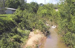
The photo above is of Howell Creek behind the Farmers Market on St. Louis Street, after a rainy period, with a lot of sediment in the water. Since the photo was taken, the trees and most of the vegetation have been removed from the streambanks.
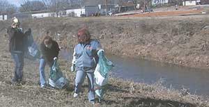 Like
most urban streams, Howell Creek collects trash. These Stream Team volunteers
are picking up lots of trash along the creek behind the Neathery Skate
Park. The streambanks have almost no vegetation to protect against erosion.
Like
most urban streams, Howell Creek collects trash. These Stream Team volunteers
are picking up lots of trash along the creek behind the Neathery Skate
Park. The streambanks have almost no vegetation to protect against erosion.
West Plains Middle School 5th grade science classes organize Stream
Team cleanup efforts to collect and remove trash from the creek. There
is also a Stormwater Drain Stenciling
Project with the Girl Scouts participating.
Galloway Creek, a tributary of Howell Creek, is a year-round stream.
40 acres of Galloway Creek property has been developed into a recreation
area, Galloway Creek Nature Park, within
the city limits of West Plains.
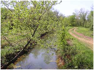
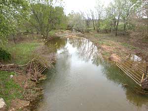 As
it flows out of the city, Howell Creek runs through fields and pastures.
This photo, taken at the ZZ Highway bridge, shows evidence of erosion
along the banks and cow trails down to the water. The gates can be closed
when the water is low and cattle move from one side to the other.
As
it flows out of the city, Howell Creek runs through fields and pastures.
This photo, taken at the ZZ Highway bridge, shows evidence of erosion
along the banks and cow trails down to the water. The gates can be closed
when the water is low and cattle move from one side to the other.
Eventually, Howell Creek flows into the Warm Fork of the Spring River.
![]()
![]()
 The
development of content for *Our Watersheds Our Homes* is funded in part
by the U.S. Environmental Protection Agency Region 7, through the Missouri
Department of Natural Resources, under Section 319 of the Clean Water
Act. DNR Subgrant #G04-NPS-17.
The
development of content for *Our Watersheds Our Homes* is funded in part
by the U.S. Environmental Protection Agency Region 7, through the Missouri
Department of Natural Resources, under Section 319 of the Clean Water
Act. DNR Subgrant #G04-NPS-17.