 Grand
Gulf
Grand
Gulf
Spring River Watershed
![]() Spring River Photo Tour
Spring River Photo Tour ![]() Grand Gulf
Grand Gulf
|
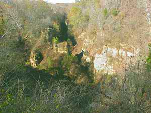
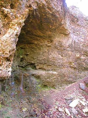
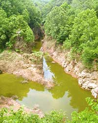
Grand Gulf is a spectacular collapsed cavern featuring steep limestone/dolomite cliffs. It's now a State Park, just up the road from Thayer on Highway W. Here at Grand Gulf is a cave system with a roof that collapsed an estimated 10,000 years ago. The result is a vertical-walled canyon about three-quarters of a mile long. The area in this photo is called Grand Junction, where two valleys, which were cave passages before their roofs collapsed, join. Rain from approximately 20 square miles drains into these valleys. |
 |
|
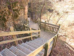 |
South Canyon Trail The trail to the bottom of the canyon is 1/8 mile, descending 70 feet in 119 steps.
|
|
|
See more photos in the Master Naturalists Grand Gulf field trip journal.
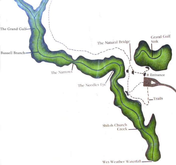
It re-emerges a day or so later, 9 miles away, at Mammoth Spring, Arkansas. Mammoth Spring flows as much as nine million gallons of water per hour, part of it from the Grand Gulf.
|
||
 The
main contributor of water to the Grand Gulf chasm is Bussell Branch.
This stream drains 25 square miles into the canyon, then disappears
into a cave underground at Grand Gulf Sink.
The
main contributor of water to the Grand Gulf chasm is Bussell Branch.
This stream drains 25 square miles into the canyon, then disappears
into a cave underground at Grand Gulf Sink. Photos and text by Peter Callaway. The
development of content for *Our Watersheds Our Homes* is funded in part
by the U.S. Environmental Protection Agency Region 7, through the Missouri
Department of Natural Resources, under Section 319 of the Clean Water Act.
DNR Subgrant #G04-NPS-17.
The
development of content for *Our Watersheds Our Homes* is funded in part
by the U.S. Environmental Protection Agency Region 7, through the Missouri
Department of Natural Resources, under Section 319 of the Clean Water Act.
DNR Subgrant #G04-NPS-17.